after powering-on, the altitude is 0m, it reads well.
but after about 5 mins? I’m not sure but it suddenly changes to -17m or -18m.
I tried to reboot pixhawk and disconnect the battery and connect again but it was same.
I experience it before also.
despite, I could flew my VTOL well.
in the indoors, with connected with USB cables, the altitude is 0m, I couldn’t reproduce error in indoors. so I suspect GPS or terrain data is affecting something on altitude.
details are belows :
-VTOL model : XuWing VTBird 4+1
-FC : Pixhawk Orange Plus
-GPS : Here 3+
-Flight time : about 50 times successfully
-Wind : was not so strong.
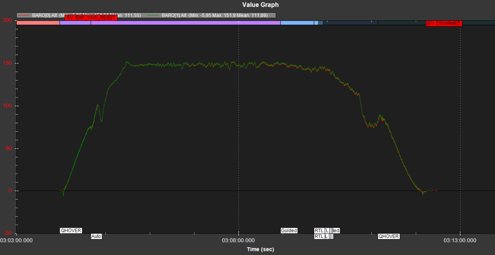
-Flight Log Link :
Strange thing is, I see altitude in mission planner -17m, but in the log, AHR2 alt is not minus value.
I notices that the altitude doesnt change if no homeupdate is done.
What i also noticed is , that many visualizations including QGC and Mavproxy visualize the RAW GPS altitude instead of the (GPS,BARO,etc) fused altitude, therefore GPS altitude can change alot.
BTH I havent checked mission planner, only QGC and Mavproxy, and i think this can confuse people. But i also need to check this out again. You can also report this as Issues.
But its also strange why its still zero all time if no home position update is done, as there also the GPS altitude is chaning ±10m depending on your sat count. Only if home position update is done, these changes are also visualized, i have to the feeling.
It would be intersting to see your home update. As also you need to provide a altitude with it.