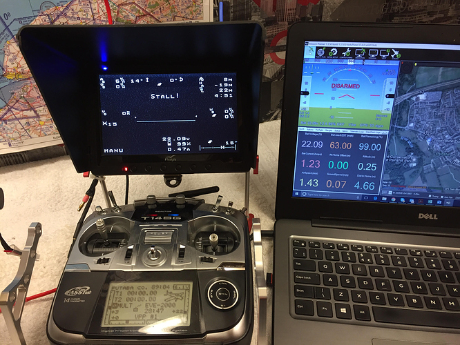
Can anyone advise as to why my OSD seems to be confused about height? If you look at the pic below, top right corner of the OSD, the height “HA” is shown as -19m (ie. underground!). This is after booting up and leaving the model at rest for a few minutes.
My understanding is that this field is meant to show the model’s height relative to take off point. Correct? Note that the elevation shown “MSL” is right for my location (22m).
The HUD in Mission Planner looks fine so it appears as if something is wrong with the OSD. I have 5 fixed wing aircraft all with Pixhawk and Minim OSD (same firmware) but only this one seems to have the issue.
Any thoughts?
