The geofence is not uploading in copter 4.0.1. It shows " This vehicle does not support geofence" in QGroundControl and in Mission Planner the marking and uploading of polygon is not working.
1 Like
Thanks for the report. These issues are really down to the GCS developers so they are a bit out of my hands.
Here’s the issues that I know about for MP. @meee1 says that he’s resolved them but I haven’t yet gone back to check.
I’ve raised the issue with QGC here although the issue has been closed, I think it still persists. Maybe @DonLakeFlyer has some input.
I think the best thing to do is perhaps comment on the two issues above.
1 Like
I’ve retested the latest Beta MP and it does appear that it can upload and download all the fence types. It can be a little fiddly but it can be done. Below is a screen shot of two inclusion polygons, one inclusion circle and one exclusion circle.
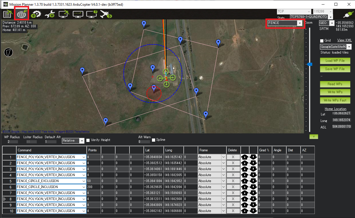
What’s especially tricky is when you enter a polygon you must then type the number of points in the polygon into each row’s “Points” field.
1 Like
Ok thanks. But what can be done with QGroundControl because i was planning to use Herelink with my PX4.
Try the Daily Build of QGC.
Hi,
I am also facing the same issue when I try to upload a geofence using mission planner it does not upload an shows there was an unexpected error it but if I try to upload using the USB cable it uploads perfectly. I have read a couple of reply on various forums and figure out it is due to some telemetry does not support the mavlink2 protocol. I have set serial port protocol as mavlink 2 still no luck. I am using 2.4 Ghz communication using wifi and even if I try to upload it using . Does anyone know how I can fix this?
Forgot to mention I am on ardupilot copter 4.0.3 V firmware.