Hi,
I’ve tested DSM following flying over building and worked fine.
FC : Matek F405 wing
FW : AP 3.6.5
Model : AR900
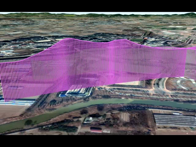
For preparation, I made DEM data by mapping 300m x 300m around the building by Mavic Pro
Hi,
I’ve tested DSM following flying over building and worked fine.
FC : Matek F405 wing
FW : AP 3.6.5
Model : AR900
For preparation, I made DEM data by mapping 300m x 300m around the building by Mavic Pro
Hey,
I’m trying hard to make a follow terrain flight based on custom DTM map that I made, but cannot make the pixhawk follow the terrain heights successfully.
when I flew based on the SRTM data, the pixhawk followed successfully the terrain heights, but when I loaded the DTM map, the drone flies 43-46 meters above the terrain height.
In the DF logs, I see that the terrain height that loaded to the pixhawk is the heights from the DTM map.
Maybe you have an idea that can help me?
Hi Guy,
Did you check this discussion thread? I think it works for you.
Hi Kyomo,
Yes I already read all the discussion there, I have followed the instructions and still not working well.
If you have any idea for me it will be great.
Thanks.
Can you share the DTM map with me?
Yeah sure.
Do you want to send me your mail? it’s too big to upload here.
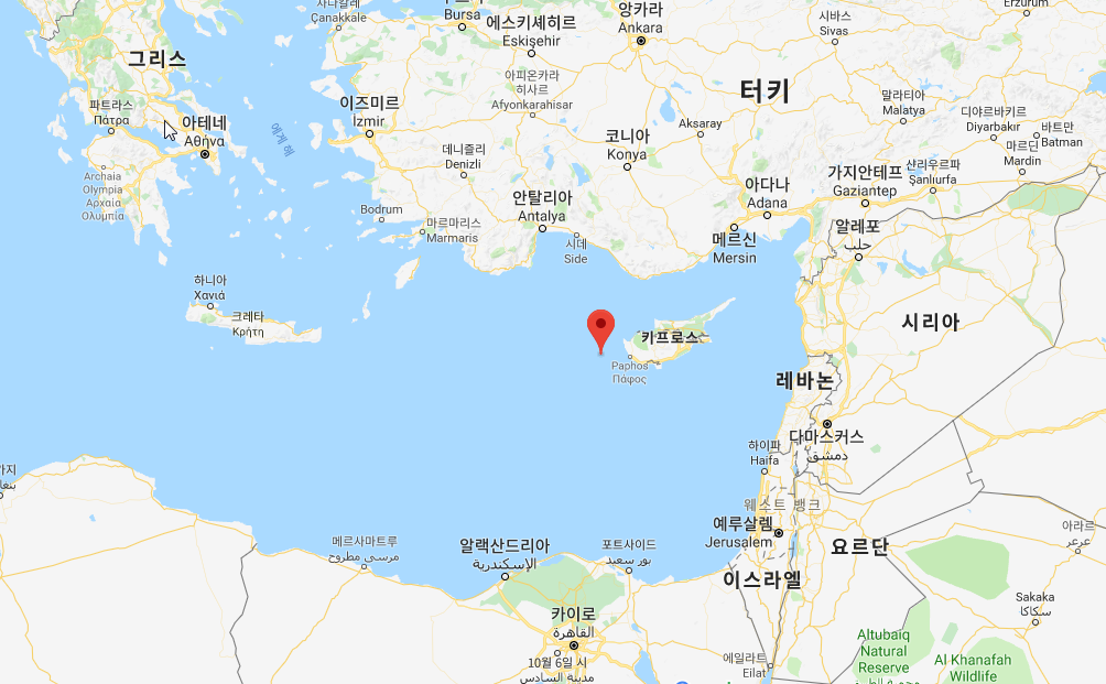
Guy,
The first picture below shows the area your DEM file pointing.
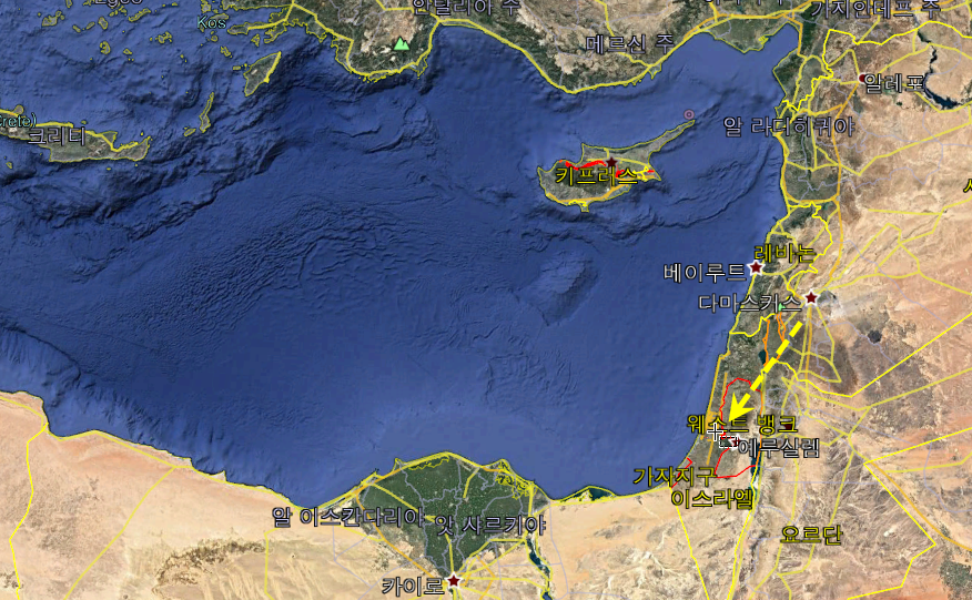
And the next picture is saying the area your craft flied.
I think your DEM has wrong geo data.
What coordinate system you used?
Cause we checked the map and we saw it in the area we flew and it was OK.
We are using WGS84 - epsg4326.