This topic is for support and discussion of the SCurves feature in Copter-4.1.
4 Likes
Here is the part in my talk where I compare the old and new navigation paths:
4 Likes
This reminds me at a time more than 30 years ago when I tried to produce the first hardcopies of my digitized contour lines. To make them not look like polygons some CAD designers used spline which I found straight from the beginning to inaccurate. It worked only when a Hill side was shaped like a round cake. In nature that is hard to find. So I used S- curve only. Later on I supplied digital data only which was compiled from Aerial photography because my clients used there own CAD software.
This was the time well before drones and other unmanned aircraft were used for photogrammetry work.
I could not resist to put that here today. At the time I was wondering when Mission-planer started using splines but kept it for myself until today.
2 Likes
I ran a Mission today that performed perfectly. A couple of Spline entry/exit waypoints and a simple grid with some elevation changes. The navigation thru the waypoints is impressive.
Looks very good!
*ignore the motor outputs, this craft was at very light weight.
4 Likes
Thanks for giving it a try. This log looks very nice. Following a good path and the vehicle is very well tuned too.
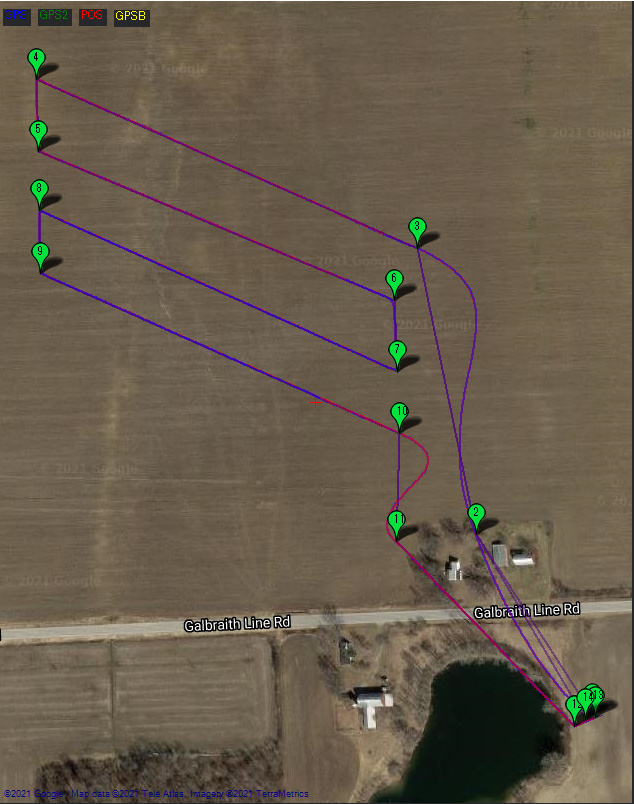
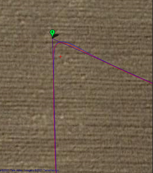
Here’s an example corner showing off the new shape
4 Likes
Looking good! You can see the nice smooth changes in the yaw too.
Just got to get Dave to improve the tuning on that copter 
2 Likes
Created https://github.com/ArduPilot/ardupilot/issues/17250 to track a problem where terrain database is required even for relative spline waypoints.
1 Like