Hi all,
I build an AAT (Ardupilot Antenna Tracker) according to the instructions provided by ardupilot docs. However, I do not want to establish a 433Mhz connection between my copter and AAT because copter is too small. Therefore I would like to feed AAT with Crossfire (CRSF) GPS data provided by my Taranis (e.g. line out). Therefore I read many conversations, but none could actually teach me how to convert CRSF raw GPS data into AAT compatible format. Is there something new or do I not comprehensively understand this issue?
Thank you in advance.
Sebastian
I don’t think this is currently possible using Tracker, it expects a mavlink vehicle to track, you maybe able to convert the CRSF data to mavlink somehow. Maybe you would explain your setup in more detail, i’m not familiar with Crossfire gps data.
Rumour has it we can track ADSB-supplied vehicle positions, too 
We have several places in the code where we track vehicle positions other
than our own, and at least one place does it much better than Tracker
does - and that’s the AP_Follow library.
AP_Follow only tracks a single vehicle - that’s a drawback - but it does
extrapolate the vehicle’s position ('though as yet untainted by a Kalmann
filter  )
)
Ideally we start to incorporate the best aspects of all of our vehicle
tracking into one place.
- ADSB’s vehicle database (times things out based on last update,
multi-vehicle) - AP_Avoidance (takes from ADSB and from mavlink GLOBAL_POSITION_INT,
multi-vehicle)) - AP_Follow (takes from mavlink directly)
- AP_Mount (takes from mavlink directly)
- AntennaTracker (GLOBAL_POSITION_INT and random other messages)
… and the places I’ve forgotten…
1 Like
Hi Peter,
thank you for the quick answer. Please find attached a Screenshot of Taranis OpenTx Firmware, where the new option of acccessing Raw data is mentioned.

Using this option, u360gts project discovered a parsing algorithm which transformed raw data into “readable” data. Please refer to this url: https://github.com/raul-ortega/u360gts/issues/47
So my idea is, to get raw gps data from my taranis via AUX-port and connect it somehow to the AAT in an AAT readable format. By this, AAT would be pointing on my model, as long as my Taranis gets GPS signal. This would work with any GPS equipped model.
Kind regards, Sebastian
Dear Peter,
this is interesting, never heard of it before. If I get it right, a specific ADSB Unit has to be attached to my model and the position of my vessel becomes public available, right?
Kind regards, Sebastian
whats at the other end of the crossfire link? If it does mavlink it looks like you can do RC and mavlink. ie method 2 in the link you posted.
Hi Peter,
I don´t get your question and the concept described completely.
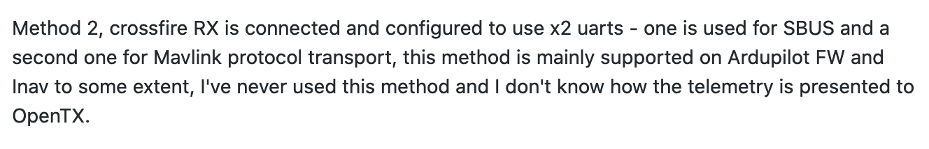
Method 2 seems to connect regularly my model by CRSF and tries to connect to AAT by sbus and mavlink? If this is true, the AAT needs a Rx as well?
With regard to your question, I do not know whats meant by “other end”? Sorry.
Kind regards, Sebastian
Tracker wants only mavlink, so method two gets you that. What are you tracking with the tracker? If its Inav or ArduPilot you should be able to use mavlink.
Hi Pete,
thank you. Yes, it is Inav. So the clue is to steer the model by mavlink and passthrough mavlink-telemetry to the AAT? I obviously do not understand method two because I do not know whats meant by using two UARTs. Until now I only use one UART for each peripheral device on a FC (e.g. GPS, Rx, etc)
Can you see where I am thinking in the false direction?
Kind regards, Sebastian
With the provision that I have never used Inav or crossfire.
I think you get two serial connections with crossfire so your first crossfire serial link can go from your RC transmitter to inav rc input, your second crossfire link can got from inav mavlink serial port to tracker mavlink serial port.
Yes, you are right. But, in this scenario AAT and inav equipped model must have a connection on their own, which is provided by an additional 433mhz Transmit/Receive LORA system. But, since I am sitting next to my AAT while flying, I would like to link Tx and AAT to provide GPS.
I believe the Crossfire TX module is able to send data in MavLink format. It’s an option in the CRSF channel settings. You may be able to add a BT receiver to your AT and setup the crossfire TX to send MavLink data through its Bluetooth connection to your AAT.
I have had bad experiences with mavlink2 and crossfire. Reported the issue, but it did not get fixed.
So join me, complain to TBS and it might get fixed at some point.
1 Like
Did you try MavLink1 as well?
The RTCM_DATA Mavlink 1 message does not get routed.
So Mavlink1 does not work.