Hi Michael,
I had this working previously, but can’t get it working now. I doesn’t seem like Mission planner is recognizing the GEOTIFF in the SRTM folder.
Any help is appreciated.
Thanks,
Dave
Hi Michael,
I had this working previously, but can’t get it working now. I doesn’t seem like Mission planner is recognizing the GEOTIFF in the SRTM folder.
Any help is appreciated.
Thanks,
Dave
please see my previous comment.
recent MP versions moved the folder. to make it windows store compatible.
Thank for the reply. I had to reinstall mission planner from the App Store. After I did that it worked well.
Thanks,
Dave
How can one test if the Custom GeoTiff is loaded within MP?
I’ve re-installed MP, now with an existing srtm folder.
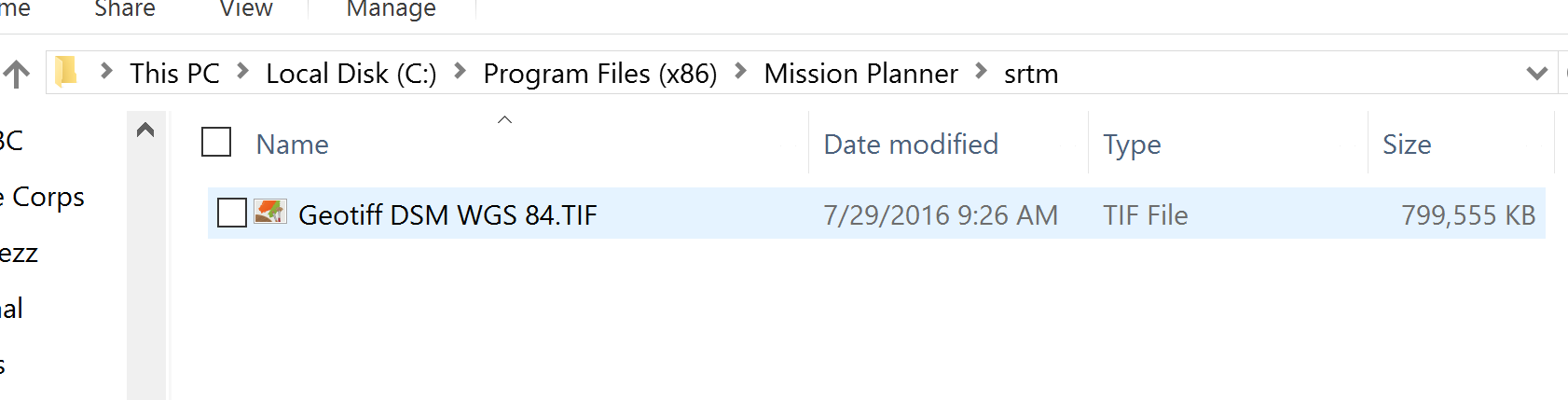
I created a GeoTiff file for our mine site in WGS84 (Long, Lat) projection, and placed it in the srtm folder.
I moved all other files originally within the srtm folder to another folder location.
i.e. the only file within the srtm folder is the custom GeoTiff of the deep open pit.
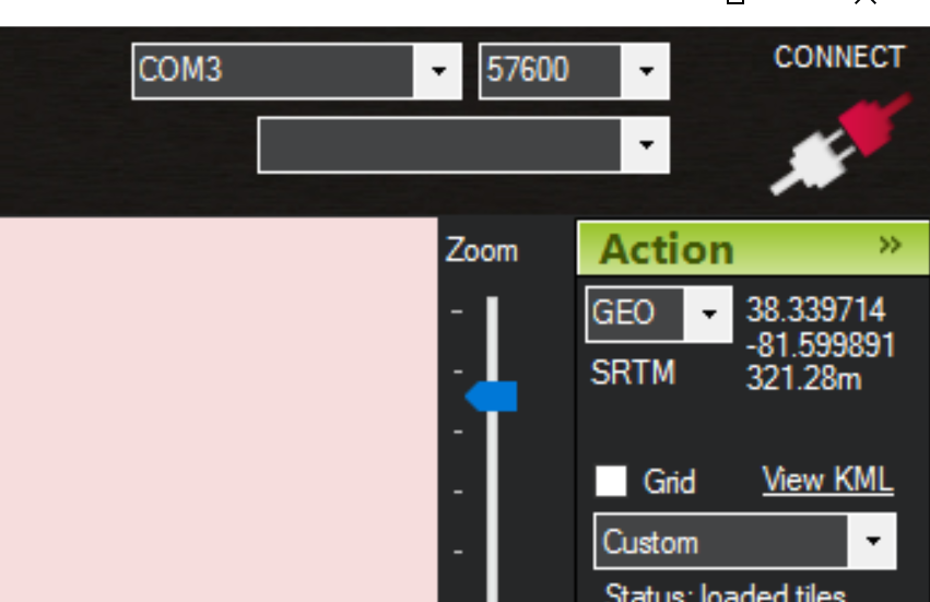
However when I view the Flight Plan page in MP, using the ‘Custom’ pull-down map option,
the cursor pointer displays the same elevation as would when using Google Earth Satellite (i.e. the incorrect elevation data), and not vertical data from the custom GeoTiff.
How would I differently test if MP is using the custom GeoTiff?
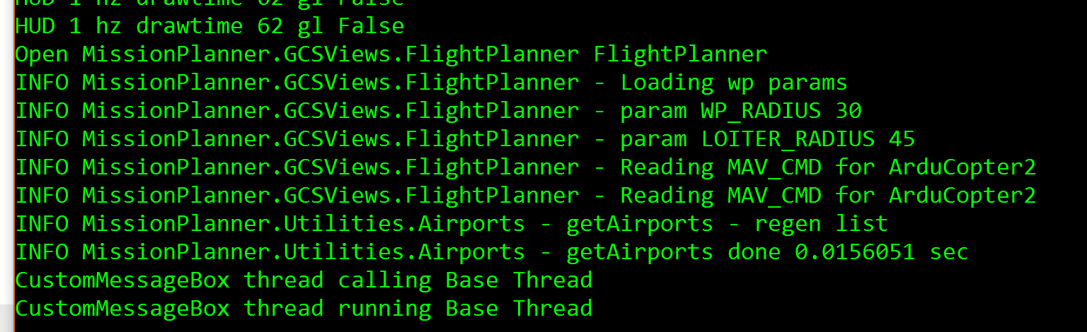
I notice some users can view a black&white text window.
If this is a method, I’ve been unable to view it. How can I gain access to this text window?
I notice some users can view a black&white text window.
If this is a method, I’ve been unable to view it. How can I gain access to this text window?
I think you are referring to the debug console. Under the help tab check the box next to show console. Once you get this opened two screens should appear when you start mission planner. In the debug console you should see your file loaded.
Also, wondering how you created your GEOTiff?
dave
the srtm folder has been moved in newer MP versions.
C:\ProgramData\Mission Planner\srtm
try there.
Alright an update on my progress. So it appears this isn’t working the way I previously communicated. My custom imagery is working great for mission planning. I can see the image with great resolution and have high fidelity elevation data. I plan the route with my custom imagery, select terrain and upload load my mission to the flight controller (Copter 3.4.4 on a Pixhawk). Instead of loading my GEOTIFF, Mission Planner loads SRTM data (which is insufficient for my application). I removed the SD card, loaded my GEOTIFF and deleted SRTM data. And I set terrain_spacing to 0, thinking this might inhibit SRTM data loading. Went through the process again, it it uploaded SRTM data to the flight controller and seemingly ignores my GEOTIFF.
To put it succintly, Mission Planner recognizes and uses the GEOTIFF; However, the flight controller doesn’t.
Anyone have any luck getting this to work?
Thanks,
Dave
Michael,
Thanks for your reply advice.
However,
My Mission Planner (MP) was automatically installed under a different
directory (not C:\ProgramData\Mission Planner).
No ‘ProgramData’ folder is found on my C drive.
My Mission Planner was automatically installed using the following
directory,
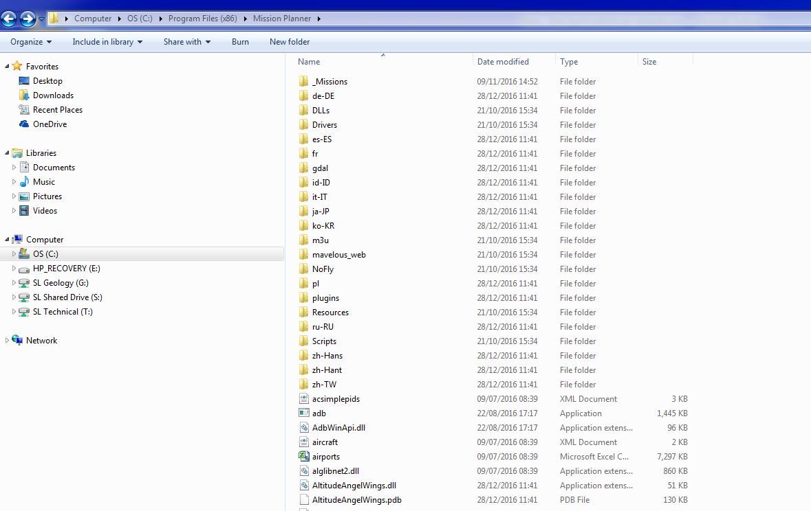
C:\Program Files (x86)\Mission Planner. This installed on corporate
work computer, using Windows 7.
Under my MP directory, no srtm folder was created. (see image capture of my
MP Directory).
If you kindly send a web address for a trusted MP download, I will
reinstall a clean copy.
Given Google Earth (GE) vertical data is very different (as much as 100m
above developing open pit elevations), and also given variations in slope
direction are also very different to GE. Also, given terrain slope is very
steep 30 - 40 degrees, terrain hugging is highly advantageous for
photogrammetry.
As for MP using custom vertical data (GeoTiff), we in the mining world
deeply desire this capacity for our drones to hug custom mine terrain.
As for MP development, It shines above all others. Well Done!
Alan (Jonty) Seymour
Michael,
I uninstalled MP, and then reinstalled a new copy via
http://ardupilot.org/planner/docs/common-install-mission-planner.html
In looking in the new MP folder 'C:\Program Files (x86)\Mission Planner’
I see that no srtm folder was created.
To also confirm, a folder ‘C:\ProgramData\Mission Planner’ does not exist
on my C drive.
Do I need to force installation of MP into a newly created folder ‘
C:\ProgramData’?
Jonty
Hi, I succeded loading a GeoTiff DTM in WGS84 produced with Global Mapper, OK!
I had tried before with the same GeoTiff done with ArcGIS: MP saw it but elevation was always at 0: any issue or tips for why? Thanks
I suspect the GEOTIFF doesn’t contain the elevation data. Send me a link to the geotiff and I’ll take a look.
David Here you may find both: The ArcGIS (AGIS10) and the Global Mapper one (GM12). The ArcGIS one has Z info. Thanks for your interest. Alberto
Looks like both of the attachments have elevation data. Not sure why you are not seeing the elevation data.
Perhaps this thread will help Custom Imagery in Mission Planner
I began reading on this topics just from the discussion you pointed: I’ll read again and try to read the console messages. Did you try my files in MP? Thanks again,
Alberto
I didn’t load your info in mission planner just global mapper. Please send me a good decimal degree lat and long coordinate for the center of the area and I’ll load it into MP.
Here they are: 42.276531 14.026902 DD
Got it!
I can see it in MP. My guess is you are placing the flie in the wrong location. Here is the path to my srtm folder. I lives in the programdata folder; C:\ProgramData\Mission Planner\srtm. Drop your file in there and you should be good to go.
Dave
Did this work for you?
Hi David, of course I had put in the right directory: the ArcGIG was loaded but show 0 quotes in its bounding box, while the Global Mapper shows right coordinates: this is the problem!
May be it is a decimal separator (. or ,) issue? I have an Italian OS (which should use comma as saparator) on which I set dot as separator…
Ok, it’s an easy mistake to make as there are two SRTM folders; one in the mission planner folder where mission planner is installed and the other in programdata\mission planner\srtm.
The reason, I am reiteratating this is because I see the elevation data from global mapper in mission planner, which confirms the file is properly load and formatted. So you should see it too, unless its in the wrong folder.