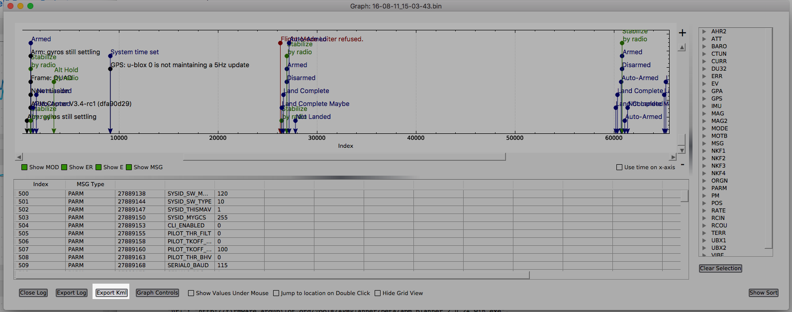
My Traxxas Aton quadcopter collects data in the form of a .bin file on a microcard. I want to end up with a .kmz file to be viewed in Google Earth and I’m using a Mac to get the job done. My research tells me that in Mission Planner I would go from .bin to .log and then to .kmz and I’m wondering if my downloaded APM Planner will do the same? I tried the process with a ‘dataflashlog’ that I found in one of the posts that had a suffix of .bin. I met obstacles along the way. Suggestions?
Thank you. That helps me to know that I’m on the right path. Eventually, as in most things, it will become routine but for now the distinctions between binary log files and text log files and resulting KML and KMZ files are spinning around in my head.
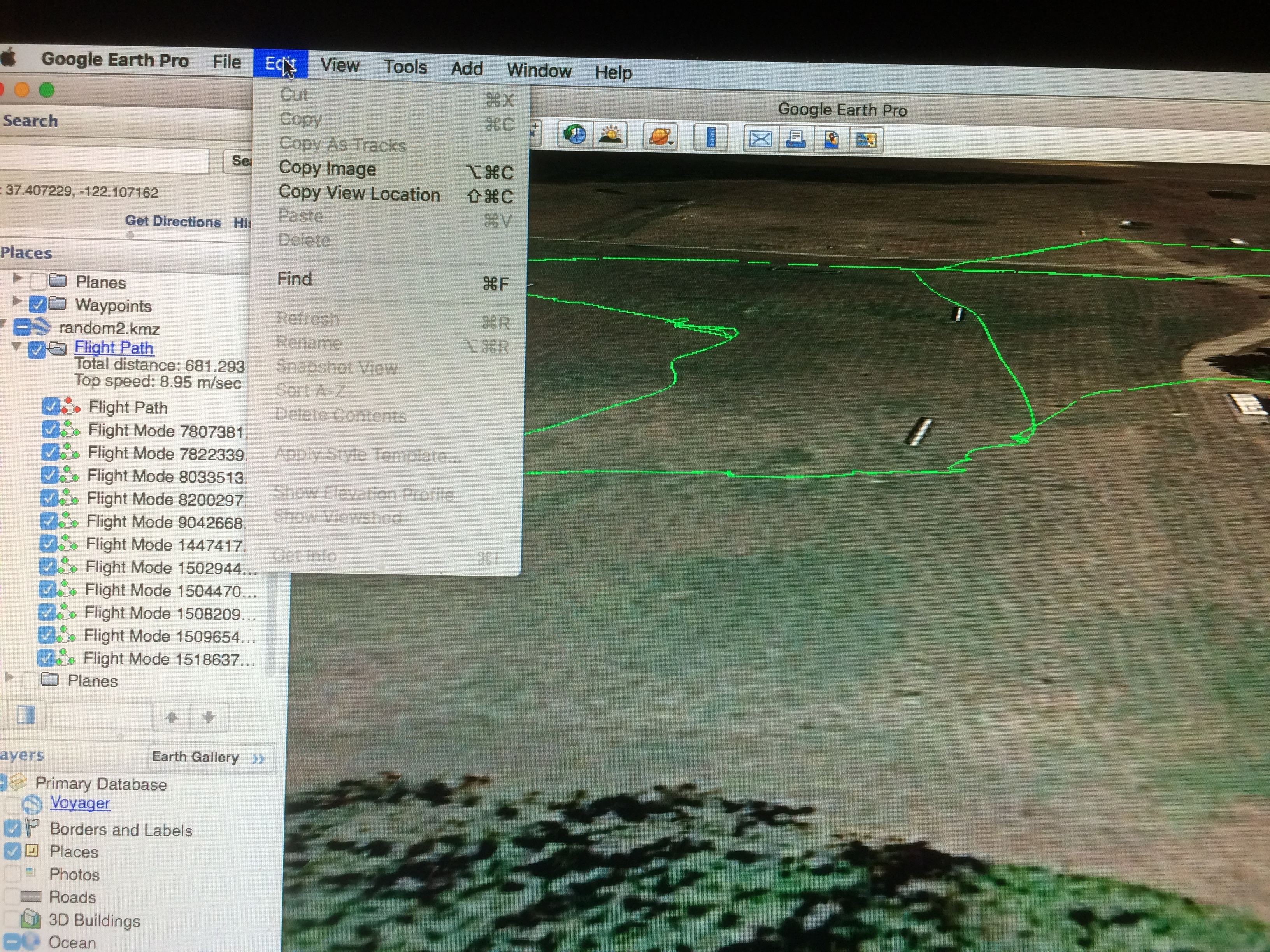
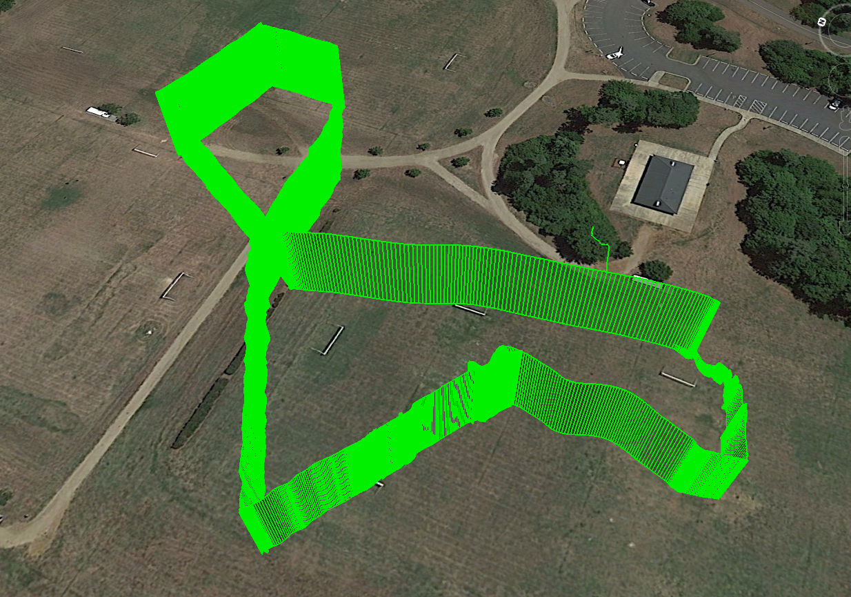
Your link turned out to be good for several hours of study. Thanks. I’m ‘analyzing’ this fellow’s file to try and learn some of the lingo and get into the nuts and bolts of the graphing capabilities of APM2. He posted the file in the Log Analysis section because he experienced a crash. I’ve called the KMZ file ‘random2’ and it shows in my list of places in Google Earth Pro. There it is, pretty as can be somewhere in South Carolina, but it doesn’t look like the beautiful roller coasters that I’ve seen using Google Earth. And, the Show Elevation Profile option under the Edit menu is ghosted. Drat! I’m so close. Do you have any idea why the ghosting is going on? I’d appreciate any suggestion. Here is a screen grab link.
I apologize if the image is upside down. It’s right side up everywhere else!! Some days are just like that and this is one of those days. I’ll try to get it turned around somehow. Geez! Evidently, the forum software decided that it needed to be turned over.
Let’s try this…I had to go all the way back to my camera and turn it over. Let’s hope this works.
\removed failing link\
Oh, my goodness. That is just too weird. It wants to display this upside down and there seems to be no remedy, Crazy!
Hmmm…display gremlins…looks OK to begin with…sigh.
Can you post the log? or PM me
Thank you for offering to help! I’m going to try some other logs and see if I don’t get better results. I thought that it would be efficient to check out some of these logs and pretend that they are mine but maybe, because they are ‘problem logs’, that wasn’t such a good idea. If my efforts don’t yield some positive results then I’ll impose on you once again. Then, I’ll do a little research into how to PM you!
Heck, let’s see if I can get the two logs I was working with into this note. One is called 115.log and the other is practice4.bin Let’s see if I can just drag them.
Sorry, it says the files are too big and I’m feeling super inept at the moment so I’m going to tackle it again tomorrow after a good night’s sleep. Usually, things look brighter in the morning.
Thank you for your generosity.
This is what you are looking for. There is a bug… I will fix it (The 3.2.1 to 3.3.3 release renamed RelAlt Alt and some other changes) I’ll post when a fix is available for download
I posted a fix it should be in http://firmware.ardupilot.org/Tools/APMPlanner/daily/2016-10-11 or http://firmware.ardupilot.org/Tools/APMPlanner/daily/2016-10-12 soonish for macOS/OSX
Thank you for your help. When the elevation profile started looking so
goofy in Google Earth after looking so reasonable in the Planner program I
thought that maybe I was up against something beyond my abilities. I look
forward to using the fix.